
At the bottom of Lookabootye Brae on the southern edge of Clackmannan, there was once located a sandstone quarry. By the 1920's it was disused, the workers having dug through the sandstone to the coal seams below in places, as noted on the 1924 Ordnance Survey geology map.
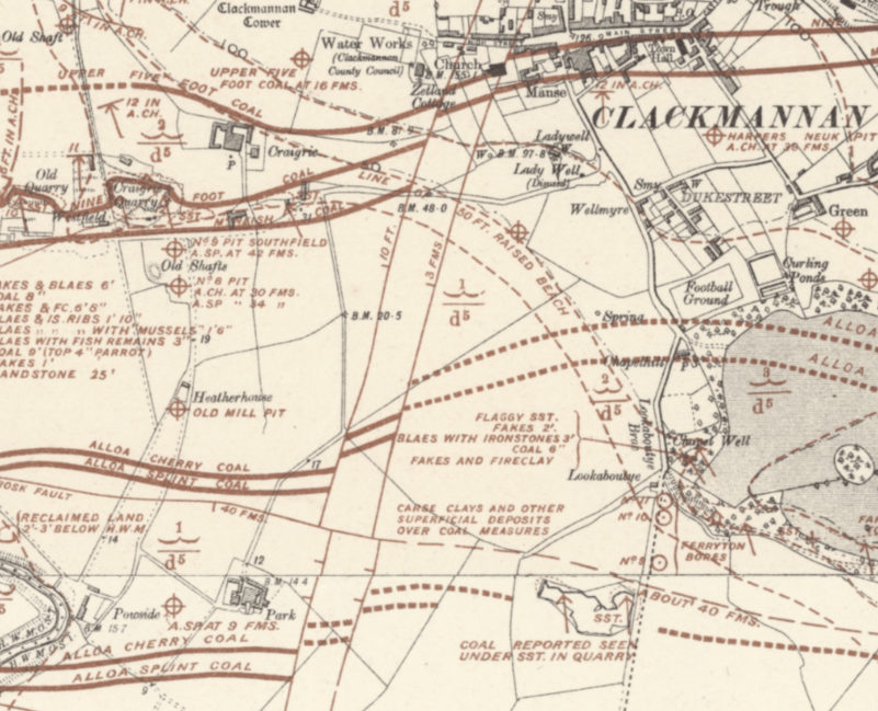
OS Map, Geology, 1924 Quarry is located south of Clackmannan No. 9 Coal Pit.
The abandoned quarry, it's floor being below the water table, soon filled with water. The quarry outline can be seen in the 1940s aerial photo below.
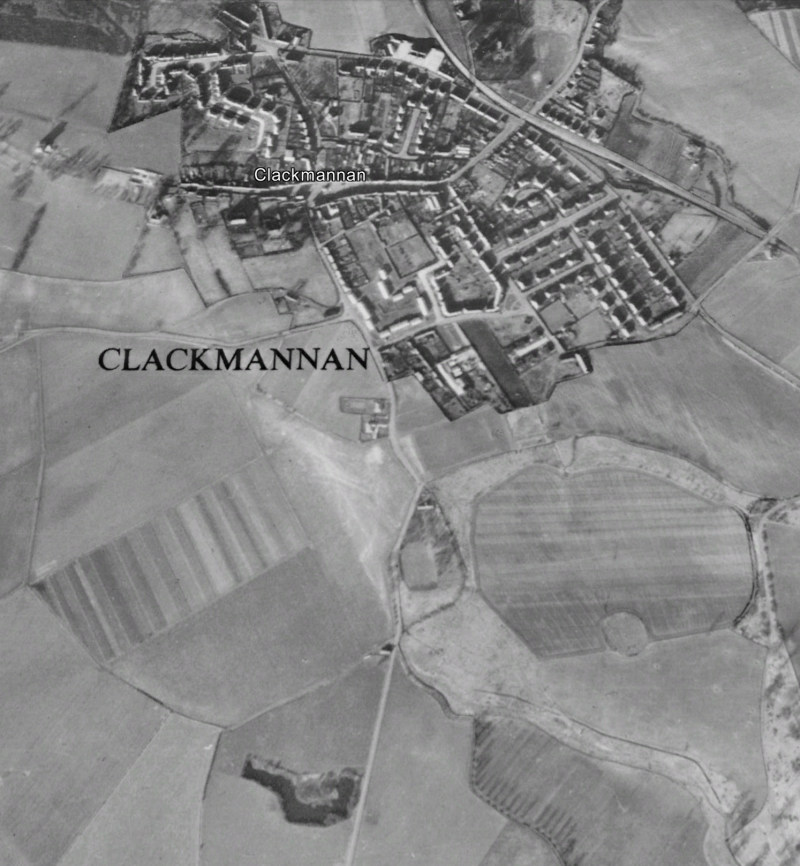
1945 aerial picture (Google Earth) - shows the water filled quarry, and access from the road on the north edge.
Over time the quarry came to be used as a rubbish dump, and was by the 1950's observed to be 'about half the size of a football pitch'*. The site was to play host to a tragedy in the mid to late 1950's.
The remaining area was filled with water and the surrounding land had returned to nature, with bushes and such lining the quarry edges. The water, unable to drain away, was contaminated and the surface was coated with a layer of grime, which is said to have resembled a solid surface, masking the dangers below. On the day of the tragedy day a truck had entered the quarry and had begun to unload, when the driver's mate got out of the cab for a look around. Somehow he ended up in the water, and was unable to retrieve himself. The driver called for the emergency services, and it is known that the police and ambulance services attended. The police launched a boat on the water were able to locate the body, local Bobby PC Botham being responsible for the recovery of the body.
The quarry was eventually completely filled-in and remediated to farm land.
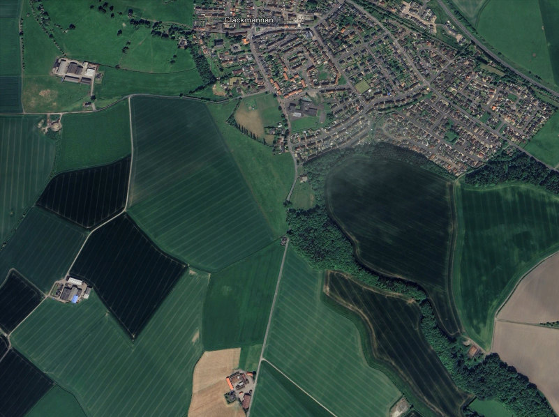
Picture: Google Earth 2025 - Quarry long since filled in.
References :
*Memories of a Clackmannan Lad 1947 - 1958, by William Wood (2012).
maps.nls.uk
Google Earth