
Clackmannan Pier, located in the area known as Clackmannan Pow, was situated on the eastern edge of the river Black Devon, at its confluence with the River Forth, about 1.5 miles south of Clackmannan village.
Once a thriving port, providing coal, wool and salt for export, the port was supplied via a waggonway track from the many local mines around Clackmannan.
Little remains of the port or the pier, as it fell into disrepair when the port silted up, allowing the local neighbouring port of Alloa to expand and take over the business.
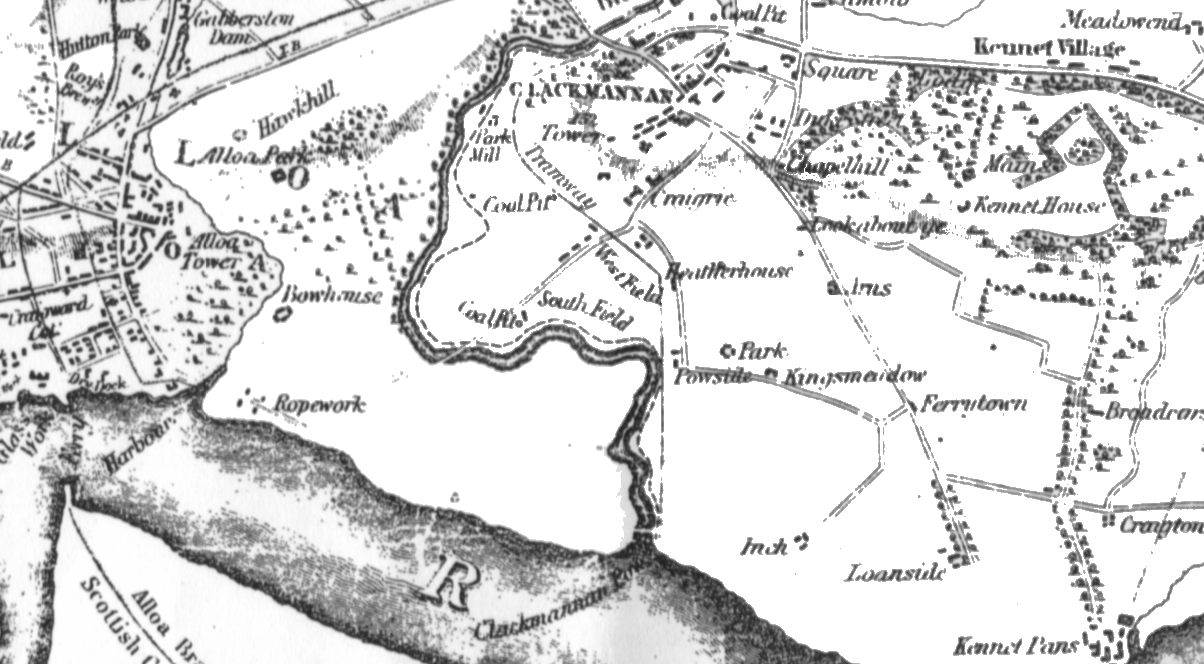
OS map extract circa 1848
Clackmannan Pow
This name is applied to the Black Devon from Powside to its junction with the River Forth. The centre of the low-water channel forms the boundary between the parishes of Alloa and Clackmannan.
Clackmannan Pier
A small pier, used for the exportation of coals, erected at the junction of the Black Devon with the River Forth. A series of tramways connects it with almost all the coal pits in the north-west of the parish.
- Rev Peter Balfour - OS name books 1861-1862.
Clackmannan Pow
Clackmannan Pow, a harbour in Clackmannan parish. Its mean depth of water is 10 feet at the usual shipping place, and 20 at the mergence of the Black Devon into the Forth.
- Ordnance Gazetteer of Scotland 1882-1885.