The lost village of Westfield is a former coal mining settlement at the south-western foot of Kings Seat hill, Clackmannanan, on the western side of the former Clackmannan waggonway (tramway) from Craigrie farm. There were several coal mines and quarries locally which hosted small settlements, most now uninhabited or returned to farm land. The Clackmannan waggonway ran between the Earl of Zetland's mines and Clackmannan's port at Clackmannan Pow. Eventually the waggonway was joined to the Earl of Mar's Alloa Waggonway, to give access to Alloa's Harbour.
Nothing now remains of the hamlet of Westfield, which was one of the largest of these settlements, nor it's near neighbour to the north, Speedwell. In the 1841 Statistical Account, Westfield is described as one of the three principal villages of the parish of Clackmannan.
The name Westfield can be found on the James Stobie map of Clackmannanshire from 1783.
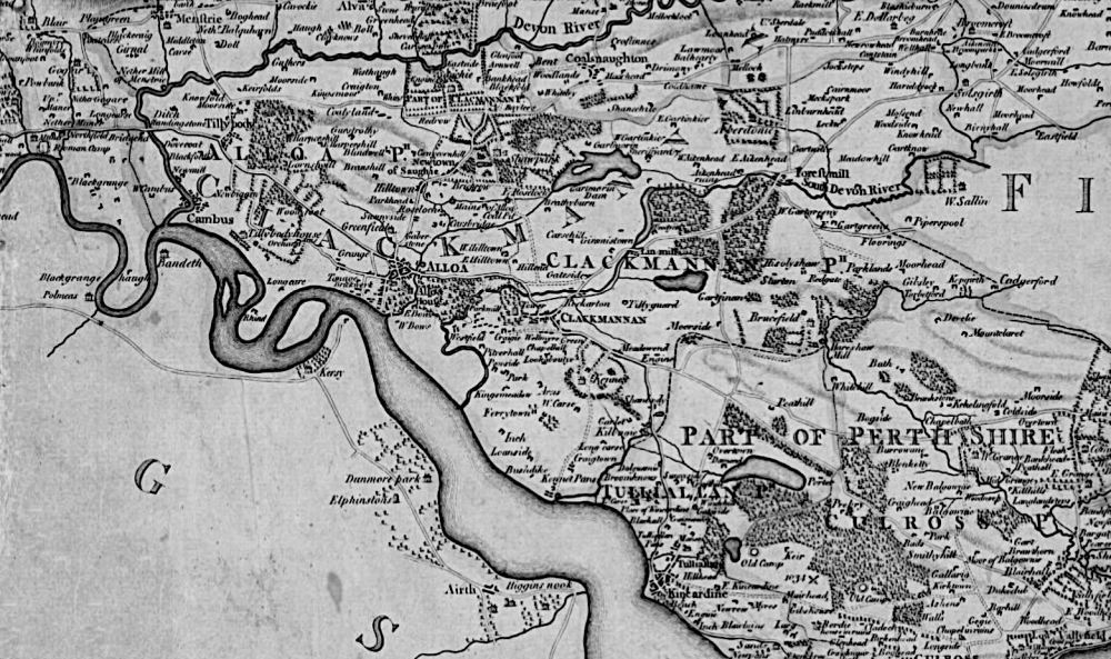
The origins of Westfield are still unclear - it's thought that the settlement originated around 1735, to support the local mining and quarrying work. The water well at Westfield was known to run dry during the summertime, the residents having to look further afield for their supply of drinking water. The Black Devon was unsuitable for drinking water at this stretch due to industry and other settlements further upstream.
The map below from around 1848 shows Westfield and other small hamlets and farms locally.
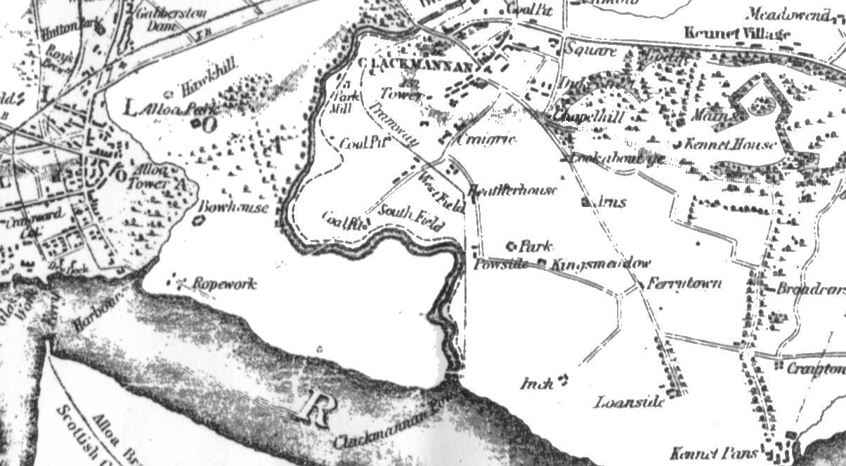
Ordnance Survey map circa 1848
This slightly later, more detailed map shows more clearly the extent of Westfield.
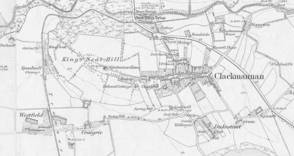
In this OS map from the second half of the 19th century shows Westfield in the bottom left corner, directly on the route of the old Clackmannan Waggonway.
A little to the north, consisting of two small rows of cottages, is Speedwell, also now vanished.
In 1875, Westfield was described thusly:
"I proceeded next to Westfield, where there are three rows - the Long Row, the Middle Row, and the Low Row, consisting of between thirty and forty in all.
Taking them in this order, we go into the first house in the Long Row, a room and kitchen. Fires are lighted in both apartments, and on the hearth-stone of the room the woman of the house has placed two trunks with the lids thrown open in order to dry the clothes which they contain. This she requires to do every other day; and the contents of the boxes are often quite moist. The room beds are placed against the back walls, and as the ground outside is above the level of the floor its is not surprising that the sleeping places are damp.
In the next house the kitchen is very damp, and the room altogether deserted. The neighbours have pretty much the same story to tell, and at the end of the row several of the tenements are unoccupied. The middle row houses are a shade better than those we have left. They are on a better level, and therefore less liable to damp. The low row is, however, the worst of the three, the houses being all unhealthy during wet weather, and more or less so even when the sky is bright. In one of them the tenant found it necessary to remove her room furniture to prevent it from being destroyed, and in another a piece of sacking laid in front of the room fire is quite black with damp. Here there are no fewer than ten persons living in a small room and kitchen.
There is no regular water supply for the village, but Mr Allan, a neighbouring farmer, kindly allows the people to help themselves from his well. In summer this permission is often necessarily withdrawn, and then the villagers go to Wellmyre, fully half a mile away, where good spring water is obtained"
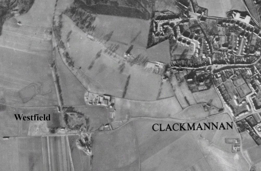
Aerial picture of Westfield and part of Clackmannan, 1945 - Courtesy Google Maps.
Mining continued at Westfield via Craigrie Mine under various owners until around 1950. As can be seen above in this 1945 aerial picture, by this time Westfield was already in severe decline and with new housing under construction in nearby Clackmannan during and after the second world war, it's likely that Westfield's remaining residents were tempted by the newly built houses with new-fangled conveniences such as mains water and electricity, and internal bathrooms. The last of the cottages, which were thought to number around 38 at Westfield's peak, were demolished in April 1962.
Only the Craigrie Mine area can still be seen today, used as a sort of storage yard for the local farm. Of the village there is now no trace, the area having been returned to farmland.
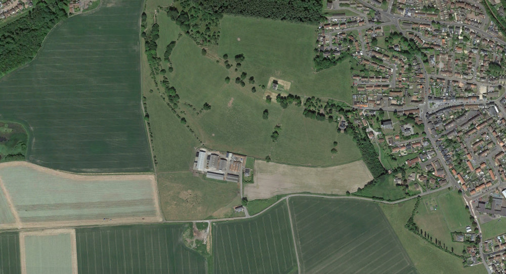
Satellite picture of Westfield and part of Clackmannan, 2022 - Courtesy Google Maps.
Reference
Clackmannanshire Name Books Volume 3
